
Among the unveilings at Google I/O, the most AR-relevant was its new Visual Positioning Service (VPS). It picks up where GPS leaves off, with way-finding and informational overlays inside the cavernous Home Depots of the world.
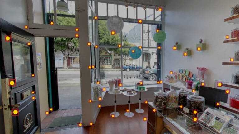
This was teased in the VR/AR keynote that we featured last week, but unpacked further in a standalone session about Tango (video below). There, we learn more about how VPS works, including the “area learning” at its core, and subsequent cloud processing.
Google first plans to map interior spaces through retail partnerships like Lowes, in addition crowdsourcing for smaller retailers. But even after those initial scans are complete, they’ll get better over time through consumer scans that are shared with the cloud.
Skip right to this point in the video for a visualization of a Lowes area mapping process in fast forward. And perhaps the coolest part of the video is a sneak peek at how Google plans to speed up future area scans by drone. The rest of the video is below. Enjoy.