
 by
by 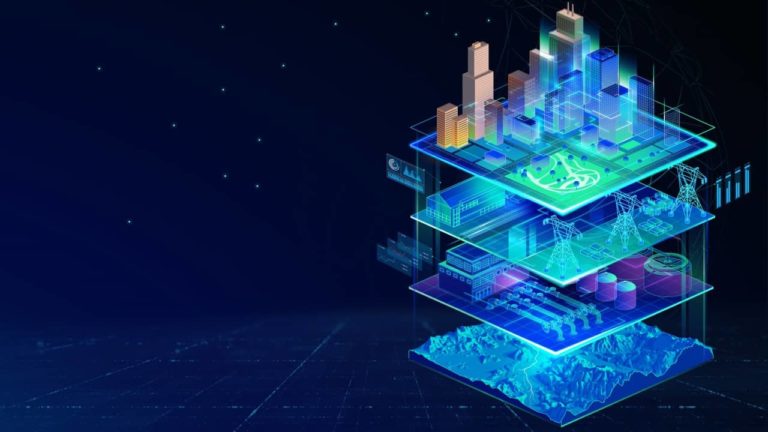

Every year, the geospatial world gathers to talk about the same promise: better maps, better visualization, better ways to see the built and natural world in three dimensions. As thousands of GIS professionals gather for this year’s Esri User Conference, the digital twin conversation is going to be everywhere on the agenda again: planning twins, 3D city models, real time operations views. That is not a coincidence.
Esri’s ArcGIS platform is one of the biggest reasons most cities, agencies, and infrastructure operators have a strong geospatial foundation to build on at all, and its own planning and 3D tools, ArcGIS Urban among them, have become a standard way organizations turn zoning and development data into something planners and residents can actually see and evaluate together.
But there is a question that keeps coming up in our conversations with planners, operators, and city departments, and it rarely gets answered by a better map.
“I can see the problem. Now what happens if I change it?”
That question is the gap between visualization and decision intelligence, and it is where we spend most of our time at SuperDNA 3D Lab.
Seeing is not deciding
A 3D model of a city, a corridor, or a piece of infrastructure tells you what exists. It shows you the asset, the terrain, the current state, often beautifully. That is genuinely valuable, and it is the layer the Esri ecosystem, among others, has spent decades getting right.
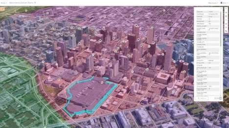
What it does not do on its own is tell you what happens next. If you increase bus frequency on a corridor, does congestion actually drop, or does it just move two blocks over? If you close a lane for maintenance, where does the queue back up, and does it reach a level that becomes a safety risk? If a storm hits, which drainage basins flood first, and by how much?
Those are not visualization questions. They are simulation questions, and they require a different layer sitting on top of the geospatial foundation, not replacing it.
What that layer looks like in practice
We call this layer decision intelligence, and we think about it as a ladder. At the base, you have visualization: seeing your assets in 3D. Above that, connected data: live feeds from sensors, IoT, and GIS sources pulled into one place. Above that, asset intelligence and predictive analytics: understanding conditions and forecasting failure.
Most platforms, including a lot of what gets built and shown in the GIS world, stop somewhere in that middle range. The top of the ladder is scenario simulation and decision intelligence: the ability to change an input and see the outcome before anything happens in the real world.
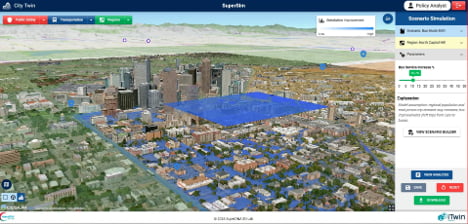
We built exactly this in a demo for the City of Denver. Using public geospatial data, including data pulled from Esri sources, layered with Cesium’s 3D streaming and Bentley’s iTwin platform, we built a live simulation environment that answers a specific question: if bus frequency increases along a downtown corridor, what happens to emissions and congestion on that corridor and the ones around it. Not a static projection. A live, adjustable scenario a planner can run themselves.
The same approach powers a tolling and transportation twin we built called TransOps, which won recognition in the Bentley iTwin Cohort in 2025. It answers a similar class of questions for toll operators: what happens to throughput and revenue if you close this lane on this day, and where does the risk actually sit?
Why this matters for the next wave of GIS
Geospatial platforms have gotten very good at giving organizations a foundation of accurate, connected data. That foundation is not going away, and we do not build it ourselves. Our platform, SuperSim, is designed to sit on top of existing GIS investments, whether that foundation is Esri, Cesium, Bentley, or a mix of all three, and add the scenario layer that turns a static model into something a non-engineer can actually use to make a call.
The industry conversation is shifting from “can we see it” to “can we test it before we commit to it.” That shift is where the next round of value in digital twins is going to come from, and it is the conversation we think is worth having openly, across whichever geospatial platform an organization has already invested in.
Geospatial platforms, Esri’s chief among them, have gotten very good at giving organizations an accurate, connected foundation. That foundation is not going away, and it is not something we set out to replace. SuperSim, our platform, is built to sit on top of existing GIS investments, Esri included, and add the scenario layer that turns a static model into something a non-engineer can actually use to make a real decision.

Jatinder Kukreja
AR Insider Thought Leaders Member